
Villa del Sol Boutique Hotel – Your Coastal Eco Escape in Playas del Coco
Villa del Sol Boutique Hotel – Your Coastal Eco Escape in Playas del Coco
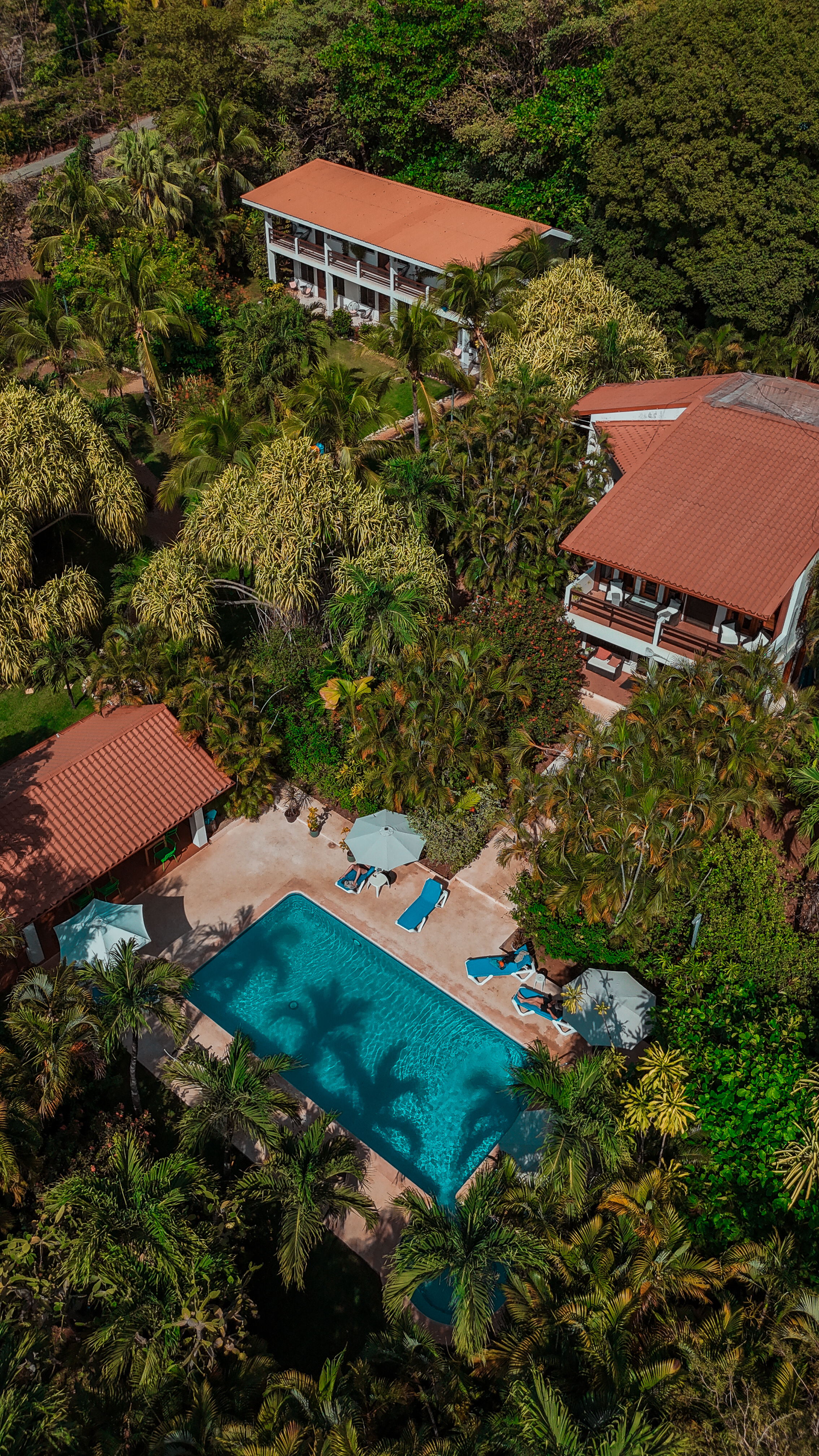
Steps from the north end of Coco Beach in Guanacaste, Villa del Sol Boutique Hotel invites you to experience the perfect blend of eco-conscious design, boutique comfort, and pura vida living. Surrounded by tropical gardens and ocean breezes, our hotel is a sanctuary for travelers who seek both tranquility and sustainability in Costa Rica.
Comfortable Spaces Close to Nature
Experience the best of both worlds at Hotel Villa del Sol. Our heritage Costa Rican villa, featuring cozy rooms, and a second building, which houses inviting studio apartments complete with kitchenettes, offer together a unique blend of comfort and convenience.
Our beautiful property is maintained with eco-friendly practices in mind, with open spaces, green balconies, and gardens, Villa del Sol allows guests to connect with nature at every turn while still being able to enjoy the comforts and amenities of a boutique experience.
Guests staying in the Villa Rooms can enjoy a complimentary breakfast-indulging in tropical mornings where your breakfast is infused with local flavors. For guests in the studio breakfast arrangements can be made upon inquiry.'
Sustainable Amenities
Each stay comes with the details that matter—like eco-friendly bath products in refillable containers, helping us reduce waste while offering guests an unforgetable, authentic Costa Rican Experience.
Our breakfast options highlight organic, fresh, and locally sourced ingredients, following a true farm-to-table philosophy. Guests can savor Costa Rican flavors while knowing their meals support the local community and environment.

Activities That Inspire Balance
At Villa del Sol, travel isn’t just about exploring a destination—it’s about finding balance for the body and mind. Guests are encouraged to enjoy activities such as:
- Yoga and meditation sessions with our yoga partner D'Arcy.
- Outdoor exercise, swimming, and nature walks by the beach.
- Eco-tours that showcase all of Costa Rica’s natural wonders.
These activities are designed to reduce stress, boost mood, and restore positive energy—so you leave feeling healthier, calmer, and more connected.

A Wellness-Focused Boutique Stay
From hosting yoga retreats to promoting healthy nutrition, Villa del Sol isn’t just a place to sleep—it’s a space to recharge, restore, and reconnect.
Whether you’re here for a romantic getaway, a family vacation, or an extended stay, you’ll find that our nature-inspired spaces, personalized hospitality, and eco-friendly practices set us apart from larger resorts in Playas del Coco and the surrounding areas in Guanacaste.


